
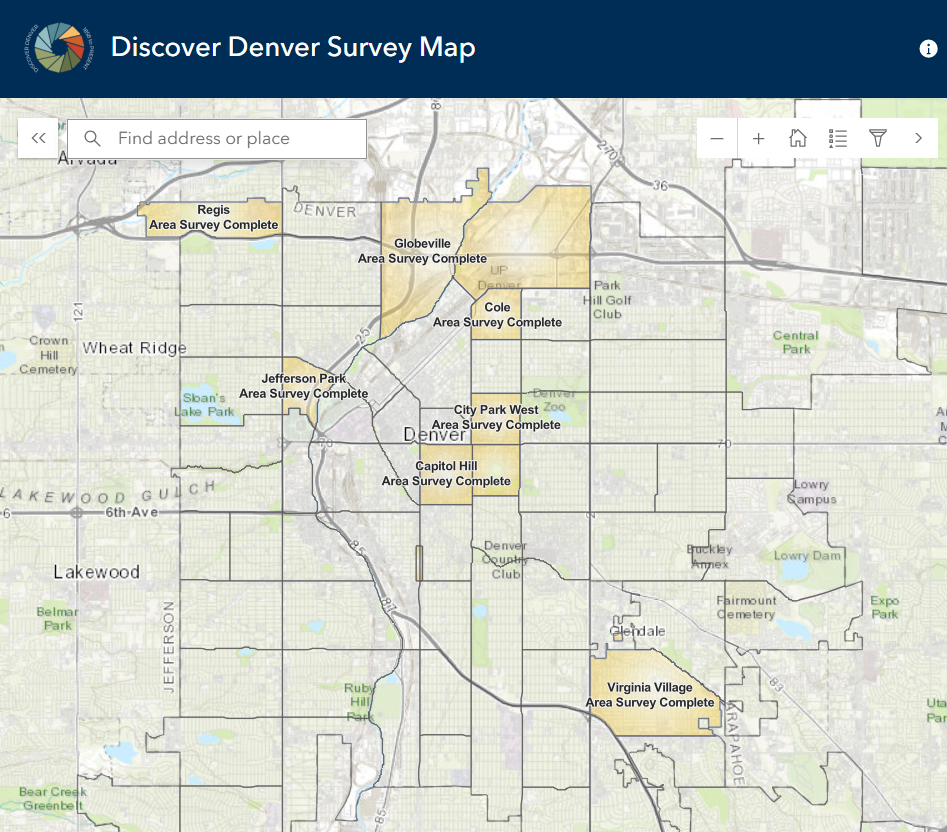
Discover Denver’s findings are available through our public map on this page and the City of Denver’s Landmark Preservation website. Click on an individual building on the Discover Denver map to learn more about the building.
HOW THE MAP WORKS
Each building surveyed will include one or more photos taken at the time of the survey, if it was possible to take one at the time. The data for each surveyed building will also include information about the year the building was built, its original and current use, the number of stories, its form or architectural style, its roof form, and its primary cladding material. Several addresses in each survey area will include detailed information about the building’s history. You will also find a link to the neighborhood history from the survey report listed under each property.
Each building was assessed for its potential eligibility for listing as a local, state, or national landmark, or as a contributing building to a local, state, or national historic district. Many of the buildings surveyed will need additional research before that determination may be made. Vacant lots and buildings under 30 years old at the time of the survey were not evaluated for eligibility.
For access, click on this link or the image of the map to the right.
FREQUENTLY ASKED QUESTIONS
Click the dropdowns for answers to frequently asked questions about the Discover Denver map.
-
There are four categories under eligibility: potentially eligible, needs data, not evaluated – under 30 years of age, and vacant lot – not evaluated.
- Potentially eligible: A property that is noted as potentially eligible may be eligible for listing individually on the National Register of Historic Places, on the State Register of Historic Properties, or as an individual Denver landmark; or the property may be considered a contributing structure to a historic district listed on the National Register, State Register, or locally designated.
- Needs Data: A property that is noted as needs data will require more research to determine whether the property may be eligible for listing individually on the National Register of Historic Places, on the State Register of Historic Properties, or as an individual Denver landmark; or whether the property may be considered a contributing structure to a historic district listed on the National Register, State Register, or locally designated.
- Not evaluated – under 30 years of age: Properties built within 30 years of the survey day were not evaluated because they are generally not eligible for local, state, or national listing.
- Vacant lot – not evaluated: Vacant lots were not evaluated because they are not eligible for local, state, or national listing.
-
No. Listing on the national or state registers and local designations are community-driven projects, meaning applications generally come from property owners or in the case of historic districts, groups of property owners. If you would like to pursue local landmark or historic district designation, please visit the Denver’s Landmark Preservation website for more information. If you would like to pursue national or state listing, please visit this website from History Colorado’s Office of Archaeology and Historic Preservation.
-
The Discover Denver citywide building survey is a point-in-time survey and photos were taken at the time the building was surveyed. If you would like to remove the photo of your property, please contact landmark@denvergov.org.
-
Yes! Please contact Sam Crowley at scrowley@historicdenver.org with any additional information you may have.
-
The map includes most surveyed neighborhoods from phases 1 through 3 of this multi-phase project. We will typically be adding a neighborhood each month until the map catches up with the current survey areas. While properties are surveyed each week, it may take several months (or more!) for the data to be evaluated and the neighborhood survey report to be completed. Check out the neighborhood map above to see which neighborhoods are currently being documented.
-
Individual landmarks, those listed on the national or state registers, and properties in historic districts were not surveyed through Discover Denver. These were already previously documented and evaluated.
-
A few historic districts were designated after Discover Denver surveyed the neighborhood, so their survey data is included in the map. For example, the buildings in the River Drive Historic District in the Jefferson Park neighborhood were found to be eligible in the neighborhood survey report. Property owners got together to have this block designated a historic district as a result of the survey.